Blog

Header photo: a drone near Brokopondo in Suriname. © Britta Jaschinski / IUCN NL
Digital technologies can contribute to conservation in several ways. For example, drones can detect activities such as illegal logging or fishing. In this way, such threats can be monitored more precisely in a short period of time and brought to the attention of stakeholders. This way, damage to nature is minimised.
Role of technology in nature conservation
After natural disasters, satellite images are indispensable for mapping the damage and identifying areas that are priorities for emergency services. Sometimes such areas are dangerous for people to enter, and the situation must be assessed from a distance to ensure safety. These types of technologies also come in handy when an area is dangerous for another reason, such as being inhospitable.
Technical means can be used not only in restoring nature, but also in researching and protecting it. For example, drones can be used to map drought and fire risk. Artificial intelligence can help predict and thus prevent deforestation.
IUCN NL supports and facilitates the use of these technologies by partners in their projects. We do this through funding, but also by collaborating on strategy or by providing training in the use of such technical tools.
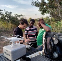
Drones monitor landscape restoration in Ghana
In central and northern Ghana, we work with local partner organisations on landscape restoration by planting new seedlings and encouraging natural regeneration. In this vast landscape, drones are providing the tools to monitor whether planted saplings and spontaneously emerged vegetation are growing properly, and whether they are spared from threats such as fire, drought and grazing cattle.
Surveying jaguars with camera traps
With the Operation Jaguar project, we supported Neowild’s jaguar research in Suriname. Using camera traps, they monitored jaguars in Suriname’s nature reserves to gain more insight into the behavior of and threats to jaguar populations. The camera traps allowed the researchers to watch the jaguars in their natural habitat around the clock and for prolonged periods, without causing any major disturbance to them.
Identifying migration routes with satellite images
In Ecuador, in collaboration with Third Millennium Alliance, satellite images were used to reconnect isolated pieces of forest in the most promising way. Indeed, these images allowed the state of possible connecting areas to be estimated, and thus the best consideration could be made to reconnect the pieces of forest. Ultimately, this led to the identification of a suitable area, where a migration route for capuchin monkey and other species of approximately 100 kilometres has now been realised.
Reduce flood risk
In Indonesia, IUCN NL partner organisation Sawit Watch used drones to map land use around the Kayan River basin. This densely populated area is increasingly struggling with flooding. With the land use information, the local government can design the land so that enough forest is spared to maintain the natural water regulation needed to reduce flood risks.
Onze experts